 70% of New York City has CSOs – Combined Sewer Overflow systems, which means that when there’s a lot of rain both rainwater and raw sewage get dumped into the New York waterways. Yuck! Cities are nowhere close to ripping out their CSOs and replacing them with healthier systems, because the infrastructure upgrades costs are in the billions.
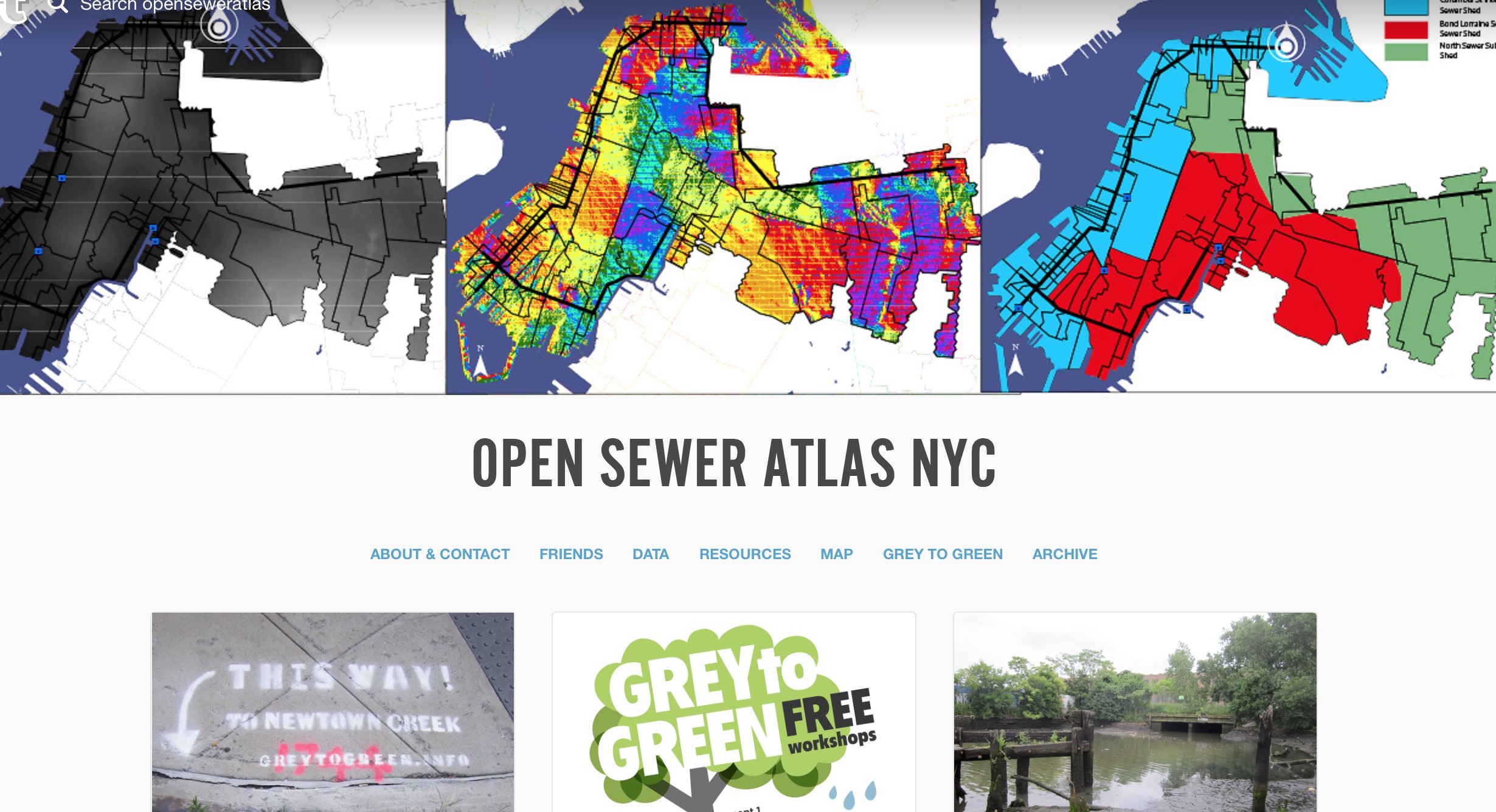
This doesn’t mean positive change has to be postponed any longer. But it does mean that less expensive, smaller scale leading edge solutions incorporating green infrastructure are more likely to emerge from the community than from city government administrations. Open Sewer Atlas NYC and Stormwater Infrastructure Matters Coalition (S.W.I.M) are two organizations working together to map sewershed/watershed areas and explore how CSO pollution’s impact on New York waters can be minimized.
…is a unique community planning project with the goal of creating transparency into the confusing world of New York City’s sewer system. The project will use publicly available maps and data from the New York City Department of Environmental Protection to create dynamic maps that display a more complete picture of how NYC’s sewer system works.
Topography, population, land use, density, and many other factors play a role in the day to day function of the sewer system. Our goal is to visualize the relationships between these factors…